|
The Tuesday Night Club Official Web Site |
The Tuesday Night Club on Tour
Tour 2005
1 - The Western half of the Witham Navigable Drains - Newham Drain, Castle Drain, West Fen Drain, Houghbridge Drain, Sandy Bank Drain and the Twenty Foot Drain.
HINTS AND TIPS
Navigation Authority for the Witham Navigable Drains (apart from the EA administered ones listed)
Witham Fourth District Internal Drainage Board
47 Norfolk Street
BOSTON
PE21 6PP
Tel: 01205 310099
Fax: 01205 311282
drainage@w4idb.co.uk
http://www.w4idb.co.uk/
Navigation Authority for the following Witham Navigable Drains:
Stonebridge, Maud Foster and Catchwater Drains:
Environment Agency Anglia Region, Kingfisher House, Goldhay Way, Orton Goldhay, Peterborough PE2 5ZR: Telephone 01733 371811 : Fax 01733 231840 :
Anton’s Gowt Lock
72ft x 14ft
Cowbridge Lock
70ft x 9ft
The Witham Navigable Drains are navigable from April to October. During the winter the levels may be lower and boats may not be able to exit over the lower cill of Anton’s Gowt Lock. A 70ft narrow boat would be able to turn on all the corners we encountered, except the junctions at the ends of Sandy Sank Drain.
It is best to contact the Witham Fourth District Internal Drainage Board before entering the drains to find out if there are any stoppages or restrictions.
We had twice tinkered with the thought of doing the Witham Navigable Drains, but neither of these attempts had been serious, as we had been constrained by time. Come the 2005 TNC cruising season, the Witham Navigable Drains had become one of our last ‘great-uncharted areas’ of the connected English waterway system, so we decided this was to be the focus of our 2005 Tour.
The Witham Fourth Internal Drainage Board was contacted and they reported back that there were no stoppages and that the low accommodation bridge on the West Fen Main Drain near where Newham Drain intersects had been rebuilt with 2.5 metres navigable headroom. This bridge had proved a problem on a previous visit, but at the time we knew it was due for replacement, having been damaged by a “car in the drain” incident.
As with all passages on drainage systems that tolerate or have a right of navigation, the state of the drains is on a “how you find it” basis. A drain that is impassable on one trip may have been grubbed out by an excavator on the next. The only “Navigation guide” we know of is a photocopied sheet showing the bridge heights and winding points available from the local IWA Branch. We had a trusty, well-worn version, dating from the mid 1990’s.
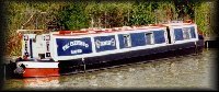
The period for the trip was set for around a week in mid July. This time there were to be no pressing navigational issues, like a Wash passage, to curtail our exploits! Crew for this part of the Tour was just three - Neil, Martin Clark and Peter Wright. There was to be no back up narrowboat, but, on the other hand, we had plenty of time to overcome any navigational difficulties encountered.
Although we had the inflatable tender with Honda 2HP outboard on board Earnest, we intended not to revert to its’ use unless the weed became too bad, which restricted our trip to air-draught constraints. This meant that any bridges with less than 5ft 3ins headroom would limit our passage.
19th July 2005
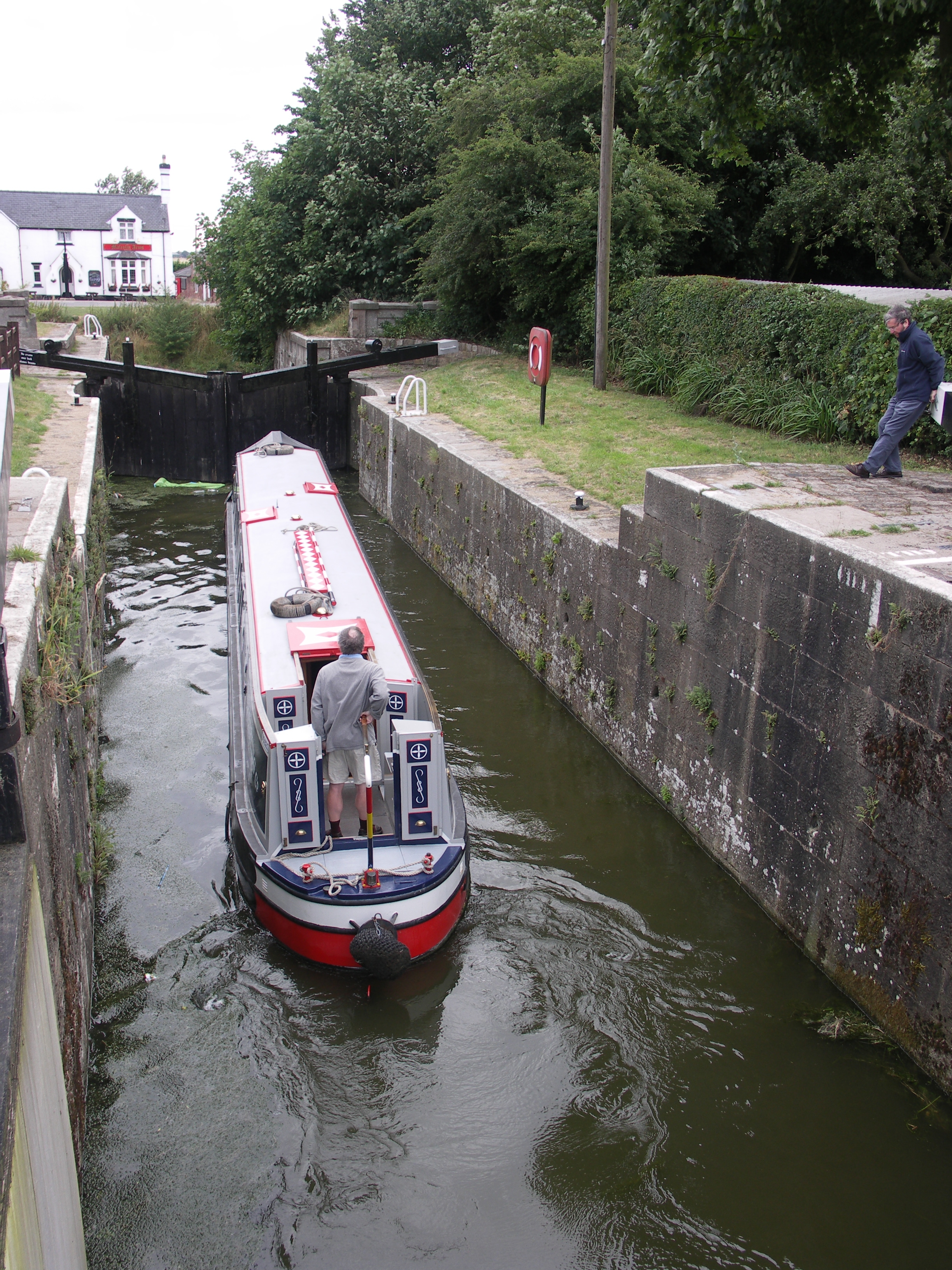
The only navigable entrance to the Witham Navigable Drains is via the British Waterways controlled lock at Anton’s Gowt. This is a couple of miles from the tidal limit of the River Witham at Boston Grand Sluice. We arrived in the early afternoon, following a passage down from Saxilby on the Fossdyke, via Lincoln. As we needed something to eat and wanted an early start the next day, we decided to push on to Boston, moor on the visitor moorings for the evening, and slip back to Anton’s Gowt in the half-light for a quite night.
Boston was surprisingly busy, with a couple of barges taking up a lot of space. The venue that night was yet another Wetherspoons, The Moon Under Water (we seemed to have navigated the system via Wetherspoons again this year!) It was a nice quite passage back to the still empty visitor moorings at Anton’s Gowt. In the fading light of a fine sunset we moored up and then took a wander round the lock to check all was well.
20th July 2005
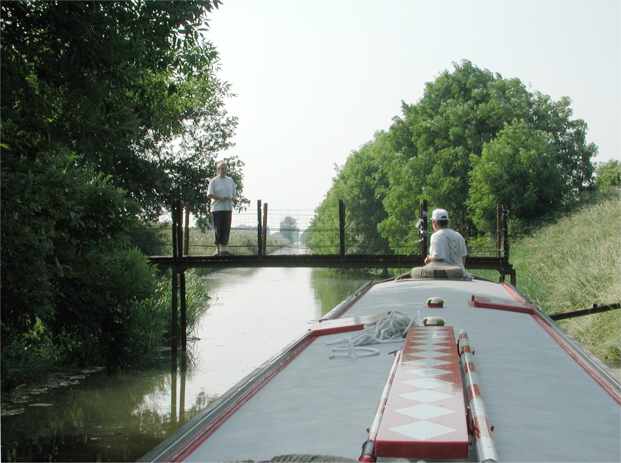
The next day started with a brilliant sunny morning, so at 06:30 we were off down Anton’s Gowt lock onto the Drains. The main level of the Witham Navigable Drains is around five foot below the summer level of the River Witham. To cope with flood levels in the River Witham the top gates are massively tall affairs. The only method of boarding the boat below the lock was a rather rickety ladder attached to the left hand wing wall.
Below the lock there is a T junction with the welcoming Malcolm Arms pub opposite. To the right, the Frith Bank Drain takes the direct navigable route to Cowbridge and hence the backside of Boston. We turned left along Newham Drain. Neil took off the cratch cover and cratch board and got out "Big Bertha", the 14ft shaft. Another junction, Castle Dyke, soon came to the left.
We did not hold out much hope here as on our previous passage we had found a new, second low pipe on Sharpes Bridge, the first bridge encountered. We reversed up, not without difficulty, and got stuck by the second pipe, 5ft 2ins above the water level. After extracting the boat we continued along Newham Drain, part of a through circular route without low bridges, which we had traversed on a previous visit.
We were surprised to grind to a halt half way along this section of Newham Drain by the B1184 Canister Hall Bridge. Next followed the arduous task of 4 hours of bow hauling and poling the boat to the cross junction with the West Fen Main Drain. Here we turned left, bound for Bunkers Hill and beyond.
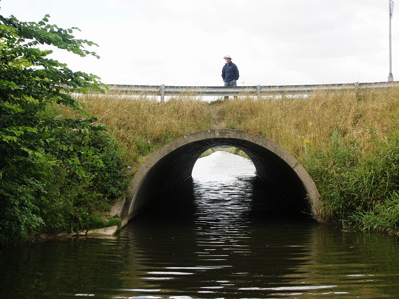
The West Fen Drain was deeper and weed free, with an easy passage under the new higher farm accommodation bridge (the older, lower bridge had stopped us last time we were here). Just before Bunkers Hill "Tunnel", a long round concrete tube bridge, there was an unexpected weed boom. Peter Wright was dropped off to deal with it and started reassembly once we were through the "tight" tunnel.
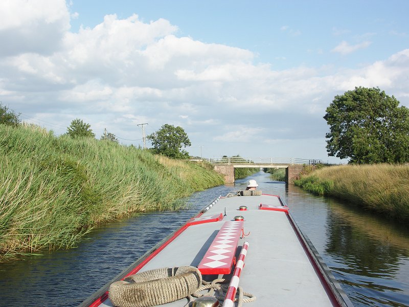
A rare TNC lunch stop ensued beyond the bridge, as the Olde Onion pub by the bridge looked so welcoming. We now carried on up West Fen Main Drain to the junction on the right with the narrow, but weed free, Sandy Bank Drain (this was to be our exit route). At this point, the Main West Fen Drain is also known as Houghbridge Drain, named after Hough Bridge, which takes the main B1192 road over the drain and though New York.
The modern flat deck Hough Bridge was quite low and the warning tyre fender over Earnest’ front mushroom vent scraped under the bridge deck. Beyond here passage was still easy and we thought it was to be the same up to the top junction with Castle Dyke (there are other low bridges at this end of Castle Dyke).
Things changed dramatically at the site of a removed weed boom, and it was a struggle up to the junction involving some poling and just the use of two shafts to wind. Back down Houghbridge Drain we did the predictable stop at Hough Bridge to walk into downtown New York, not such an impressive town as its American namesake!
By 17:30 we were back to the junction with Sandy Bank Drain and proceeded up this narrow drain. Half way along this mile-and-a-half-cut across to the top section of Newham Drain, the drain became even narrower. However, it was not too shallow, nor packed in the lower "depths" with the dreaded blanket weed.
The blanket weed on the drains is of a special variety. Once you start to pull it up from the drain floor it manages to "anchor" the prop and skeg of the boat to the bottom. The only way free is to pole and/or bow haul, whilst another crew member cuts the propeller / skeg / rudder free from the morass found in the depths of the weed hatch. It is pointless trying to pull the weed out of the weed hatch, as that procedure could go on forever. Perhaps, when sinful narrowboaters die, they experience this for infinity!..........anyway I digress. After exiting Sandy Dank Drain and proceeding down Newham Drain the anticipated weed problems started (we have had trouble here before) so we ended up poling from stern and bow through the narrow section below Mills Bridge.
Beyond the next three bridges we managed to get going again in tickover, before having to resort to poling again through the three-bridge Dovecote Hall Farm section. After this it was power on tick over to the cross junction with the Main West Fen Drain.
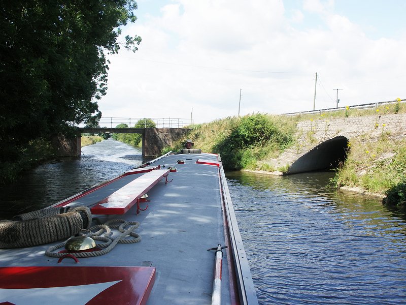
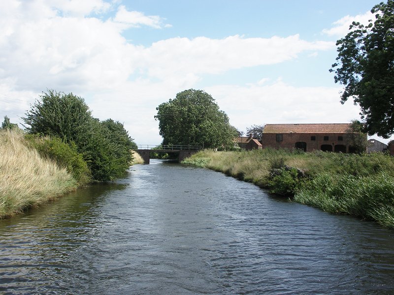
The final "bridge" is another modern corrugated steel tunnel. This one is tighter than Bunkers Hill, with a rather sharp turn after. It was now plain sailing down the deep and increasingly wide West Fen Main Drain, which is the exit channel for this end of the Witham Navigable Drains.
It was the start of a beautiful sunset when we came to the junction with the Twenty Foot Drain, a north spur off the West Fen Drain, so we decided to try to reverse a short section up this narrow drain in order to stop there for the night. This drain supposedly had a 3ft 7ins air draught bridge, not far after the junction bridge.
The junction bridge was difficult to line up (especially in reverse!) as it has concrete wash walls that curve into the channel. Once through and into the main channel, we soon found that this was going to be easy. There was the tell-tale signs of fresh mud on one bank as this drain had just been grubbed out by an excavator!
We really did fly up this tiny drain. By trailing the two shafts, hardly any course corrections were needed with the bow thruster, which could be used since there was no weed.
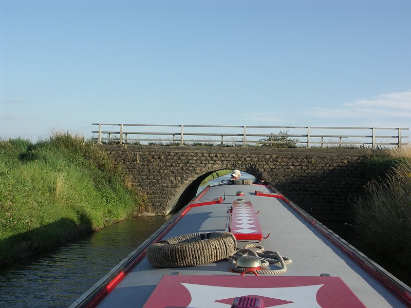
The first "low" bridge soon loomed ahead (or should that be astern?). It was a recent corrugated steel tube bridge and looked just navigable. Earnest was a perfect fit and we slid through without touching the handrails. It was still plain sailing to just above the next bridge (Westville Farm Bridge). Here the drain was stanked off, with lowered water levels, as the drain men were still dredging this next section.
Beyond the excavators the stodgy morass showed that boats could not have been up this drain for years. We had a welcoming committee at the bridge, as a friendly farmer and his sons came out of their house to take pictures and wish us well. We were invited to tie up for the night, just above the bridge. The farmer told us that having talked to the drain men, it would soon be possible to wind at the end, some quarter of a mile further, as another drain comes in from the west.
So we tied up at 21:50. Not wishing to get off the boat we simply pushed the long shaft into the clay bottom of the drain as an anchor and tied the stern rope to it. Neil was soon getting stuck into spag. bol. construction. It was one of those magical evenings - a deathly silent spot (apart from the squeaking of owls), magnificent sunset, a fine wine and meal and the fitting end to an exhausting day.

Peaceful overnight moorings on the River Witham at Anton's Gowt, by the entrance
lock down to the Drains.
Anton's Gowt Lock. This is maintained by British Waterways.

Anton's Gowt Lock.

Turning left from Anton's Gowt Lock along Newham Drain. Mere Booth Road Bridge.

Mere Booth Road Bridge. Newham Drain.

Looking back at Mere Booth Road Bridge. Newham Drain.

Newham Drain.

Castle Dyke to left, Newham Drain carries on to the right.

Weed problems down Castle Dyke.

Air draught problems at Sharp's Bridge down Castle Dyke.

Back on Newham Dyke, Canister Hall Bridge in the distance.

Looking back down Newham Dyke.

Newham Dyke bow hauling and poling, due to blanket weed.

The dreaded Newham Dyke blanket weed!
We are just turning left up West Fen Drain, at the crossroads with Newham
Drain and West Fen Drain.

Looking back, West Fen Drain to left, Newham Drain to right.
Looking back down West Fen Drain.

The new high air draught farm accommodation bridge. West Fen Drain.
The old, damaged low farm accommodation bridge. West Fen Drain.( 2001)

Peter Wright tackles the weed boom below Bunker's Hill. West Fen Drain.

Looking back at Peter Wright re-assembling the weed boom. West Fen Drain.

Bunker's Hill "Tunnel". West Fen Drain.
Bunker's Hill "Tunnel". West Fen Drain.

NB Earnest in Bunker's Hill "Tunnel". West Fen Drain.

Looking back at Bunker's Hill "Tunnel". West Fen Drain.

The Old Onion Inn at Bunker's Hill.

Signpost at Bunker's Hill.

Looking back at Bunker's Hill "Tunnel". West Fen Drain.

Looking up Sandy Bank Drain. West Fen Drain.

Hough Bridge, West Fen Drain. At this point onwards West Fen Drain is also
known as Houghbridge Drain.

The low Hough Bridge. Houghbridge Drain.

The village of New York is a few hundred yards north from Hough Bridge.

Moored under Hough Bridge. Houghbridge Drain.

Looking back down West Fen Drain from Hough Bridge.

Houghbridge Drain, approaching Bettinson's Bridge and the top junction with
Castle Dyke.

Back at the junction with Sandy Bank Drain we turn left down Sandy Bank Drain.

Sandy Bank Drain.

Sandy Bank Drain.

The junction with Sandy Bank Drain and the top of Newham Drain.

Dovecote Hall Farm Bridge. Newham Drain.

Newham Drain.

Back to West Fen Drain and the corrugated steel Westville Road
"Tunnel" Newham Drain.

Westville Road "Tunnel" Newham Drain.

Westville Road "Tunnel" Newham Drain.

Carrying on towards Boston on the lower section of West Fen Drain.
Thacker's Road Bridge. West Fen Drain.
We have turned left off West Fen Drain, to go up the Twenty Foot Drain astern.
Westville Farm Bridge, this has recently been raised using a corrugated steel
tube bridge.

The end at that moment, just above Hardy's / Beeches Lane Bridge. Twenty Foot
Drain.

The Witham Fourth Internal Drainage Board men grubbing out the Twenty Foot Drain
above Barker's yard.
Home Page | "Earnest" | "Beatty" | Canal Restoration